ТОП просматриваемых книг сайта:


География
Различные книги в жанре География, доступные для чтения и скачиванияАннотация
"Unfold a map of North America," Keith Heyer Meldahl writes, «and the first thing to grab your eye is the bold shift between the Great Plains and the Rocky Mountains.» In this absorbing book, Meldahl takes readers on a 1000-mile-long field trip back through more than 100 million years of deep time to explore America’s most spectacular and scientifically intriguing landscapes. He places us on the outcrops, rock hammer in hand, to examine the evidence for how these rough-hewn lands came to be. We see California and its gold assembled from pieces of old ocean floor and the relentless movements of the Earth’s tectonic plates. We witness the birth of the Rockies. And we investigate the violent earthquakes that continue to shape the region today. Into the West’s geologic story, Meldahl also weaves its human history. As we follow the adventures of John C. Frémont, Mark Twain, the Donner party, and other historic characters, we learn how geologic forces have shaped human experience in the past and how they direct the fate of the West today.
Аннотация
In <i>The Coming Famine</i>, Julian Cribb lays out a vivid picture of impending planetary crisis–a global food shortage that threatens to hit by mid-century–that would dwarf any in our previous experience. Cribb's comprehensive assessment describes a dangerous confluence of shortages–of water, land, energy, technology, and knowledge–combined with the increased demand created by population and economic growth. Writing in brisk, accessible prose, Cribb explains how the food system interacts with the environment and with armed conflict, poverty, and other societal factors. He shows how high food prices and regional shortages are already sending shockwaves into the international community. But, far from outlining a doomsday scenario, <i>The Coming Famine</i> offers a strong and positive call to action, exploring the greatest issue of our age and providing practical suggestions for addressing each of the major challenges it raises.
Аннотация
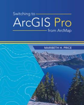
Rather than teach Pro from the start, this book focuses on the difference between Pro and ArcMap for a more rapid adjustment to common workflows.
Аннотация
Mapping Time: Illustrated by Minard's Map of Napoleon's Russian Campaign of 1812 considers the cartographic challenge of visualizing time on a map. Inspired by graphic innovator Charles Minard’s classic map of France’s disastrous invasion of Russia, this book combines historical and geographic analysis with cartographic visualizations of mapping change over time. It includes more than 100 full-color illustrations.
Аннотация
Imagery and GIS, working together, expand our perspective so that we can better perceive and understand The Science of Where™.<br> Today, most maps include imagery in the form of aerial photos, satellite images, thermal images, digital elevation models, and scanned maps. <em>Imagery and GIS: Best Practices for Extracting Information from Imagery</em> shows how imagery can be integrated successfully into GIS maps and analysis. In this essential reference, discover how imagery brings value to GIS and how GIS can be used to derive value from imagery. Learn from case studies and in-depth explanations about selecting the ‘right’ imagery, image analysis, how to efficiently manage and serve imagery datasets, and how to accurately extract information from imagery. The authors’ experience working together on numerous research, teaching, and operational remote sensing and GIS applications bestow the book with both the newest innovations, as well as proven advice.<br> Apply the best practices found in Imagery and GIS to obtain the most value from imagery in your own GIS projects.


