ТОП просматриваемых книг сайта:
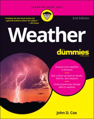
Weather For Dummies. John D. Cox
Читать онлайн.Название Weather For Dummies
Год выпуска 0
isbn 9781119811022
Автор произведения John D. Cox
Издательство John Wiley & Sons Limited
3 Chapter 4FIGURE 4-1: The basic elements of the water cycle.FIGURE 4-2: The different faces of Earth.FIGURE 4-3: This is a typical pattern that develops as winds force air up a mou...FIGURE 4-4: The California Current and Gulf Stream affect U.S. weather.
4 Chapter 5FIGURE 5-1: The general circulation of the atmosphere.FIGURE 5-2: Summer winds circulating around the Bermuda High.FIGURE 5-3: Summer winds circulating around the Pacific High.FIGURE 5-4: Air pressure changes quickly with height.FIGURE 5-5: The flow of air in the friction layer and aloft.FIGURE 5-6: The effect of Earth’s rotation on a fast-traveling object.FIGURE 5-7: Typical patterns of wind and pressure at the surface and aloft.FIGURE 5-8: Typical westerly winds and jet-stream patterns in winter and summer...FIGURE 5-9: The effect of warming and cooling on coastal and mountain breezes.
5 Chapter 6FIGURE 6-1: Cloud formations caused by the advance of a cold front.FIGURE 6-2: Cloud formations caused by the advance of a warm front.FIGURE 6-3: Mountain ranges lift air and make storms on their windward side.FIGURE 6-4: Main cloud types and their heights in the sky.FIGURE 6-5: Cirrus clouds. FIGURE 6-6: Cirrocumulus clouds. FIGURE 6-7: Cirrostratus clouds. FIGURE 6-8: Altocumulus clouds. FIGURE 6-9: Altostratus clouds. FIGURE 6-10: Stratocumulus clouds. FIGURE 6-11: Stratus clouds. FIGURE 6-12: Nimbostratus clouds. FIGURE 6-13: Cumulus clouds. FIGURE 6-14: Cumulonimbus clouds. FIGURE 6-15: Lenticular clouds. FIGURE 6-16: Mammatus clouds. FIGURE 6-17: Noctilucent clouds.
6 Chapter 7FIGURE 7-1: Hurricane-prone regions of the world.FIGURE 7-2: What a hurricane looks like from the inside.FIGURE 7-3: How storm surge takes shape along a coastline.FIGURE 7-4: Some individual hurricane tracks.
7 Chapter 8FIGURE 8-1: Earth’s tilt gives the Northern Hemisphere minimum exposure to sunl...FIGURE 8-2: Dates when freezing temperatures usually arrive.FIGURE 8-3: Annual amounts of precipitation throughout the United States.FIGURE 8-4: A satellite image of a mid-latitude storm’s big “comma cloud” patte...FIGURE 8-5: An overhead view of the main features of a typical winter storm.FIGURE 8-6: The conveyor belt model of a winter storm over the middle latitudes...FIGURE 8-7: Major winter storm tracks across the United States.FIGURE 8-8: Satellite photo of a Nor’easter storm. FIGURE 8-9: A strong jet stream keeps frigid Arctic air close to the poles whil...FIGURE 8-10: A microphotograph of a snowflake by Wilson A. Bentley. FIGURE 8-11: Common types of snowflakes.
8 Chapter 9FIGURE 9-1: The number of days thunderstorms are reported, on average, each yea...FIGURE 9-2: Life cycle of a single-cell thunderstorm.FIGURE 9-3: A single-cell thunderstorm. FIGURE 9-4: Inside a multicell cluster thunderstorm.FIGURE 9-5: A multicell cluster thunderstorm. FIGURE 9-6: A thunderstorm complex. FIGURE 9-7: Inside a squall line thunderstorm.FIGURE 9-8: Satellite photo of a squall line of thunderstorms. FIGURE 9-9: Inside a supercell thunderstorm.FIGURE 9-10: A supercell thunderstorm. FIGURE 9-11: The average number of days hail is observed.FIGURE 9-12: The electrical charges and lightning inside a thunderstorm.FIGURE 9-13: When tornadoes are likely to occur.FIGURE 9-14: Tornado Alley.FIGURE 9-15: A satellite image of a mesoscale convective complex.
9 Chapter 10FIGURE 10-1: The Sun is at highest point in the sky over Northern Hemisphere.FIGURE 10-2: Summer temperatures arrive at different times across the United St...FIGURE 10-3: Different coasts, very different air flows.FIGURE 10-4: Rainy seasons for two cities at same latitude on opposite sides of...FIGURE 10-5: Summer moisture is part of a giant air flow over the Atlantic Ocea...FIGURE 10-6: Flash flood in the Midwest.
10 Chapter 12FIGURE 12-1: Features of El Niño across the Tropical Pacific.FIGURE 12-2: Common winter weather impacts of El Niño.FIGURE 12-3: Features of La Niña across the Tropical Pacific.FIGURE 12-4: Winter weather impacts linked to La Niña.
11 Chapter 13FIGURE 13-1: Average departure from normal temperatures since 1880.FIGURE 13-2: Rising ocean temperatures since 1880.
12 Chapter 14FIGURE 14-1: The pattern of acid rainfall across the U.S. and Canada.FIGURE 14-2: Mt. Pinatubo erupts in the Philippines. FIGURE 14-3: Average temperatures dipped after Mt. Pinatubo erupted.FIGURE 14-4: The trend in carbon dioxide in the atmosphere since 1750.
13 Chapter 15FIGURE 15-1: Silver lining around a growing cumulus cloud. FIGURE 15-2: Rainbows are simply falling rain.
14 Chapter 16FIGURE 16-1: A National Weather Service forecaster releases a weather balloon. FIGURE 16-2: Researchers service the instruments on a moored ocean buoy.
15 Chapter 17FIGURE 17-1: An instrument shelter at a cooperative weather station in Granger,...
Guide
1 Cover
4 Table of Contents
6 Appendix: Internet Resource Directory
7 Index
Pages
1 i
2 ii
3 1
4 2
5 3
6 4
7 5
8 6
9 7
10 8
11 9
12 10
13 11
14 12
15 13
16 14
17 15
18 16

